By Roger Kim
An exclusive television special by National Geographic aired on February 6, 2018, revealing a vast Mayan megalopolis that lies hidden underneath centuries of plant growth and soil in the Guatemalan Forest. It may never have been discovered without laser technology.
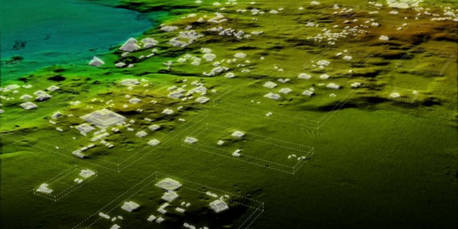
Sponsored by the PACUNAM Foundation, scientists scanned jungles in the country using Light Detection and Ranging (LiDAR) technology and found an interconnected network of ancient cities. They discovered 60,000 previously unknown structures without having to cut down a single plant; this discovery significantly changed what we knew about the ancient civilization.
Based on the sheer size of the megalopolis discovered, it is likely that Mayan populations were bigger than the previous estimate of 5 million; new estimates range from 10 to 15 million. Scientists also discovered houses, pyramids, palaces and elevated highways. Mayans did not use wheels or rely on beasts of burden, indicating that they had an organized workforce. The Mayans likely interacted regularly and might have established trade routes.
Many may associate LiDAR as a system that helps self-driving cars and robots to see their environments. However, scientists have also been using LiDAR to survey the environment without disturbing it. This is the reason that LiDAR is the perfect tool for PACUNAM’s scientists to discover the Mayan megalopolis. It would be virtually impossible to discover the ruins using a physical method. The organization plans to use LiDAR to map over 5,000 square miles of Guatemala’s lowlands in the future.
References:
https://www.nytimes.com/2018/02/03/world/americas/mayan-city-discovery-laser.html
https://www.engadget.com/2018/02/04/lidar-mayan-megalopolis-guatemala/
Google Imagine
 Tempus Magazine By Students, For Students


